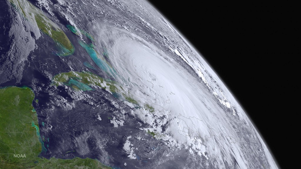
The severe hurricane that Americans have been concerned about over the past few days now might miss the east coast of the country altogether.
Hurricane Joaquin recently was upgraded to a category four hurricane, with top winds in excess of 130 miles per hour. The hurricane pounded the Bahamas on Thursday.
However, meteorologists have not ruled out an east coast strike entirely.
The National Hurricane Center posted on its website, “The forecast models continue to indicate a track offshore of the United States east coast from the Carolinas to the Mid-Atlantic states, and the threat of direct impacts from Joaquin in those areas is decreasing. Joaquin’s slow motion means that extremely dangerous conditions will continue over portions of the warning areas in the Bahamas today.”
Current prediction models suggest that the storm will continue on a northern path to the east of the Atlantic coast of the United States.
Meanwhile, Bermuda, Cape Cod and Nova Scotia remain in particular danger of the hurricane. Bermuda might be forced to post hurricane watch by the end of Friday.
As of yesterday, many prediction models showed the storm turning towards the coastline of the United States. However, weather forecasts can change quickly.
New Hampshire meteorologist Gary Best said, “This is probably going to be a non-issue. It’s a little bit early, but what we are seeing now looks pretty good.”
Meanwhile principal scientist at Weather Services International Todd Crawford said that there was more than an 80% chance that the storm would remain offshore.
However, analyst from Weather 2000 Inc. Michael Schlacter was not as optimistic.
Schlacter said, “I still contend we have to wait and see when and how this southwesterly drift stops. You are not going to be able to tell your forward speed and what influences are going to bounce it this way and bounce it that way until it starts moving north.”
Areas of Cuba have been issued tropical storm warnings, as the island country expects the outer winds of the hurricane to scrape the country. Meanwhile, islands off the Bahamas remain under hurricane warnings.
Estimates show that as much as 12 to 18 inches of rain might be dumped on the central Bahamas by the time the storm passes. Isolated cases could bring as much as 25 inches. Storm surges have the potential to raise seas by up to eight feet above normal tide levels.
Despite the positive outlook for the United States, New York is still preparing for the potential of the hurricane making landfall. Hurricane Sandy, which hit the state in October of 2012, was considerably weaker than that of Hurricane Joaquin. New York Governor Andrew Cuomo says that the state is better prepared this time around.
Cuomo said, “There’s no comparison to where we were before. I just don’t want to get arrogant or cocky because I’ve been knocked to the ground a couple of times by Mother Nature.”
Even if the hurricane does not make landfall in the northeastern region of the United States, the area is still likely to receive heavy rainfall from the storm’s outer bands.
Stay Connected